Balingen opts for PlexMap
Balingen is a town of approximately 35,000 inhabitants in southern Baden-Württemberg, located about 75 kilometers south-southwest of Stuttgart. It is the administrative seat of the Zollernalbkreis district and is situated on the edge of the Swabian Alb. Balingen serves as a regional hub for the surrounding communities.
The City of Balingen primarily uses PlexMap to display data from high-precision aerial surveys online. Its proprietary 3D city model (3D mesh) is visualized using PlexMap 3D, while true orthophotos are made available via PlexMap 2D. PlexMap Oblique is used to display the city’s own oblique aerial imagery. In total, aerial survey data from three different years is available.
We look forward to working with the City of Balingen!
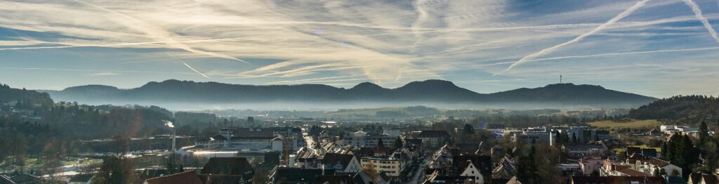
Photo: Stadtkirche Balingen – Blick vom Turm – Panoramablick nach Süden mit den Balinger Bergen: Gräbelesberg, Lochenhörnle, Lochenstein, Schafberg und Plettenberg Author: Rainer Halama License: This file is licensed under the Creative-Commons-License „Namensnennung – Weitergabe unter gleichen Bedingungen 4.0 international“.