System
Only as complex as you need it.
PlexMap is a freely configurable system for building two- and three-dimensional geodata infrastructures (GDI).
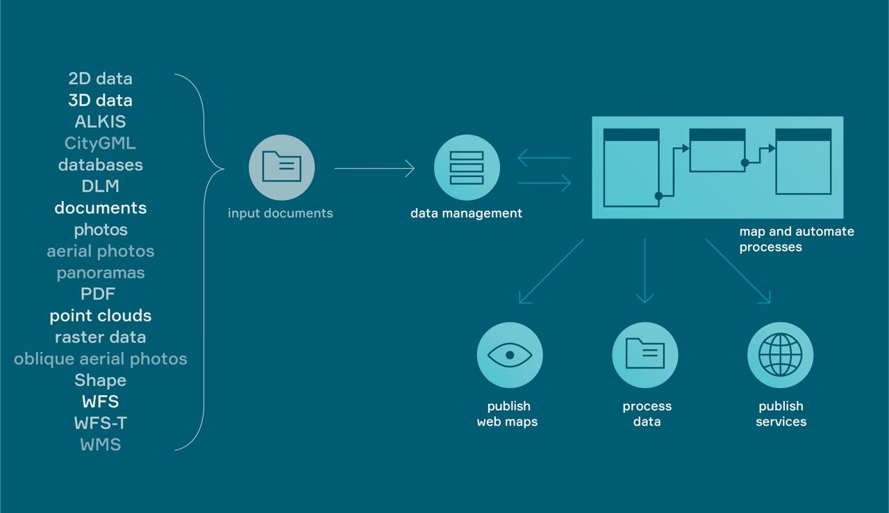
The central elements of every installation are the PlexMap Magazine (data storage) and PlexMap Switchboard (data processing) components. By selecting your PlexMap apps, you define which data you want to visualize (e.g. digital twins, oblique aerial images, development plans).
Magazine
As a central data storage system, the Magazine impresses above all with its versatility and compatibility: Manage 2D, 3D, and raster data, geoservices, and documents. No matter what you import, all datasets are versioned. This prevents data loss.
Switchboard
Our Switchboard is the heart of PlexMap. Here, you can combine all geodata from the magazine and over 300 geofunctions into practical workflows on a free user interface, thus automating processes.
Apps
PlexMap apps are specialized map applications for publishing geodata with PlexMap (e.g., PlexMap 3D for 3D data). By choosing the apps, you determine which tasks you want to solve with PlexMap.
Portal
With the PlexMap Portal, you can create and manage a geoportal. You can integrate maps from various PlexMap apps as well as maps from third-party providers into the PlexMap Portal.
The PlexMap Workflow
