PlexMap Portal
Easily create and manage modern geoportals.
Would you like to set up a geoportal with PlexMap? Then PlexMap Portal can help you present your map content clearly on a central platform.
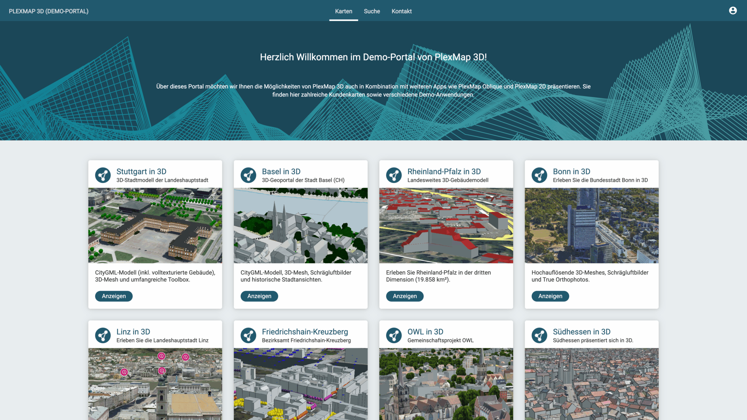
The map applications created with PlexMap are clearly presented on the geoportal’s home page, making them easily accessible to all users. It is also possible to integrate map applications from external providers.
The geoportal also offers a metadata search function. Here, users can search and view all publicly accessible layers. INSPIRE-compliant geoservices (WMS/WFS) can also be provided.
Advantages
With PlexMap Portal, you can create attractive geoportals quickly and easily. You can also design and operate multiple portals in parallel via the backend. Learn all about the advantages of PlexMap Portal!
- Clear content management: easily manage your own geoportal in the PlexMap backend.
- Corporate identity: the exact design of the portal (images, texts, colors, and maps used) can be customized without any programming knowledge.
- View Cards: Public maps created with PlexMap are visualized in a simple and understandable way using a modern tile design.
- Open: Maps from third-party providers can also be easily published via the PlexMap portal.
- Mobile devices: PlexMap Portal has a responsive design and is therefore fully compatible with smartphones and tablet PCs.
- Custom call link: Freely selectable URL (e.g., www.geoportal-musterstadt.de).
- Provision of geoservices: via the PlexMap portal, you can publish geoservices (WMS/WFS, OGC API) for all layers displayed in the portal.
- Custom maps: In the “Search” section, users can search through all publicly available layers and create a custom map.
