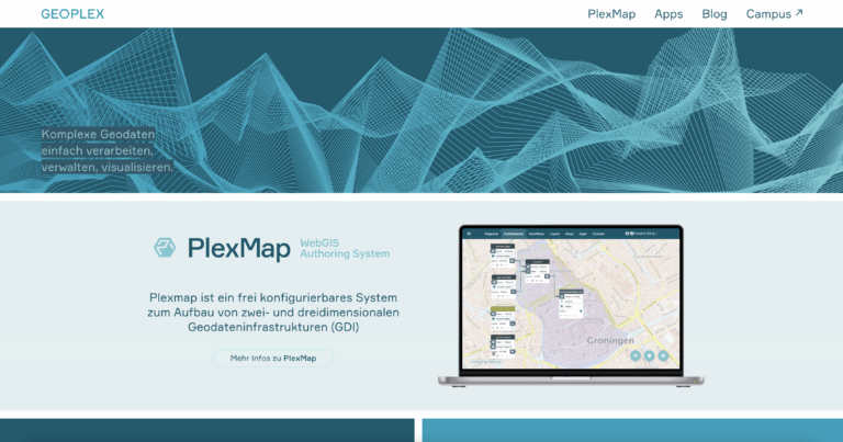
PlexMap 8.0 – Release Notes
PlexMap 8.0 has now been installed on all instances. We hope you enjoy trying it out! Find out everything you need to know about the most important new features here. If you have any questions about the release, please contact our support team.
Calculate 3D radiation
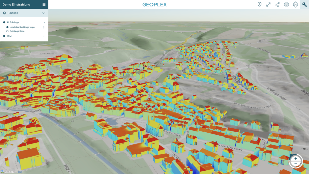
PlexMap 8 introduces the ability to perform 3D irradiation calculations in the PlexMap Switchboard. The solar potential of 3D buildings can be calculated fully automatically for large areas. In addition, solar potential calculations can also be performed for individual buildings (e.g., new buildings) (use in PlexMap Planner).
PlexMap 8.1 will also include a solar cadastre extension for facade PV, which Geoplex is currently working on.
Vector Basemaps
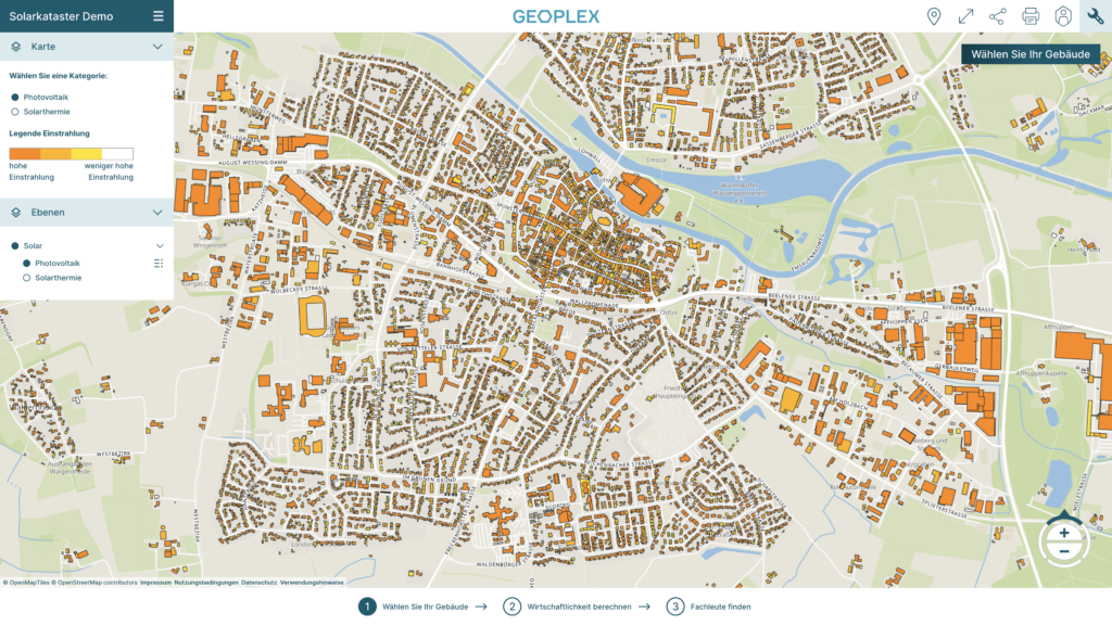
Since PlexMap 8.0, it is now also possible to create fully vector-based maps for all in-house 2D apps (PlexMap Solar, PlexMap GreenRoof, PlexMap Immo, PlexMap 2D). To this end, PlexMap now also supports vector-based background maps (vector tiles). A selection of these vector basemaps will be automatically distributed to all customers with PlexMap 8 via our blueprint. The main advantages are: no pixels in the map display, automatic translation of map content, and very pleasant loading behavior.
Major Update: PlexMap Street360°
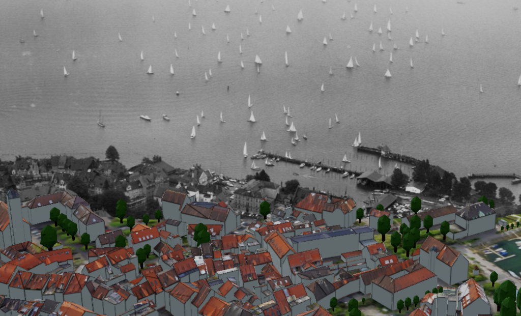
Street360° is getting a major update with PlexMap 8.0. From now on, image data will be tiled so that the full original resolution can be displayed—and with improved performance compared to the old version! Another advantage of the new version is the perspective marking of the nearest panoramic images, including highlighting. For oriented photos, there is now a slider that can be used to adjust the distance of the image from the viewer in the room (see image). There are also numerous detail improvements. Please contact us if you would like a detailed presentation of PlexMap Street360°.
Tags im Backend
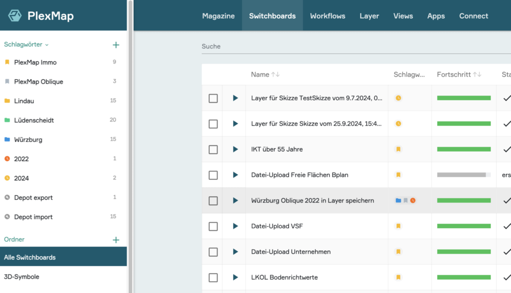
PlexMap instances start small but grow over time. To help you keep track of everything, PlexMap 8.0 introduces “tags.” Tags allow you to enrich switchboards, layers, and views with additional information (e.g., a project name or an aerial survey year) so you can find them more quickly. For easy differentiation, tags have a name, color, and symbol and can be created and managed by all administrators. Do you find the new tags helpful? We would be very interested in your feedback!
Load geoservices “live” into the viewer
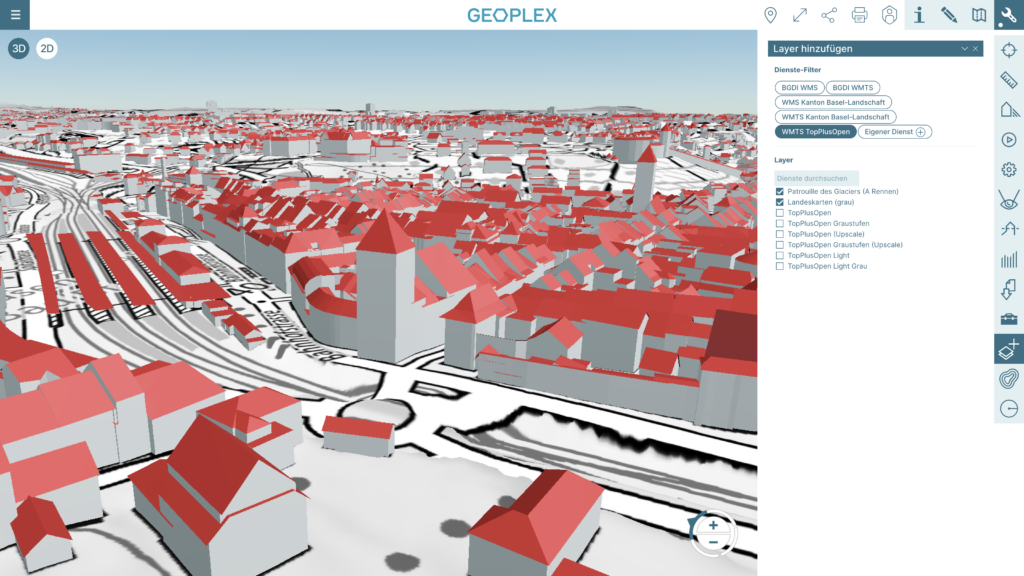
With the new services tool, any geoservices can now be loaded live into the viewer. Admins can preconfigure preselected service servers via the PlexMap backend. However, end users can also add and use service servers live. These servers added live in the viewer are only stored for the current session. In the future, 2D geodata could also be imported into the current map view (e.g., shape files). Would this be of interest to you? Please feel free to contact us.
New: TIN terrain
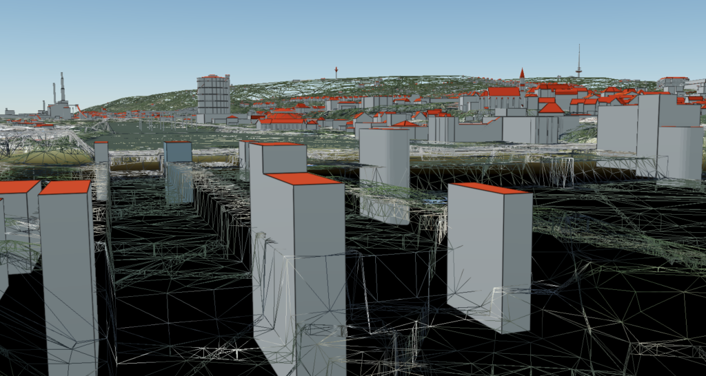
PlexMap 8.0 offers the option of preparing terrain models as triangular irregular networks (TIN) and displaying them in the viewer. Existing break lines can also be incorporated and taken into account. Compared to the raster terrains used previously, TIN terrains have the advantage of enabling sharp-edged representations. The use of TIN terrains also tends to improve viewer performance, as a TIN requires fewer points in flat areas than a regular raster.
Update: Live data
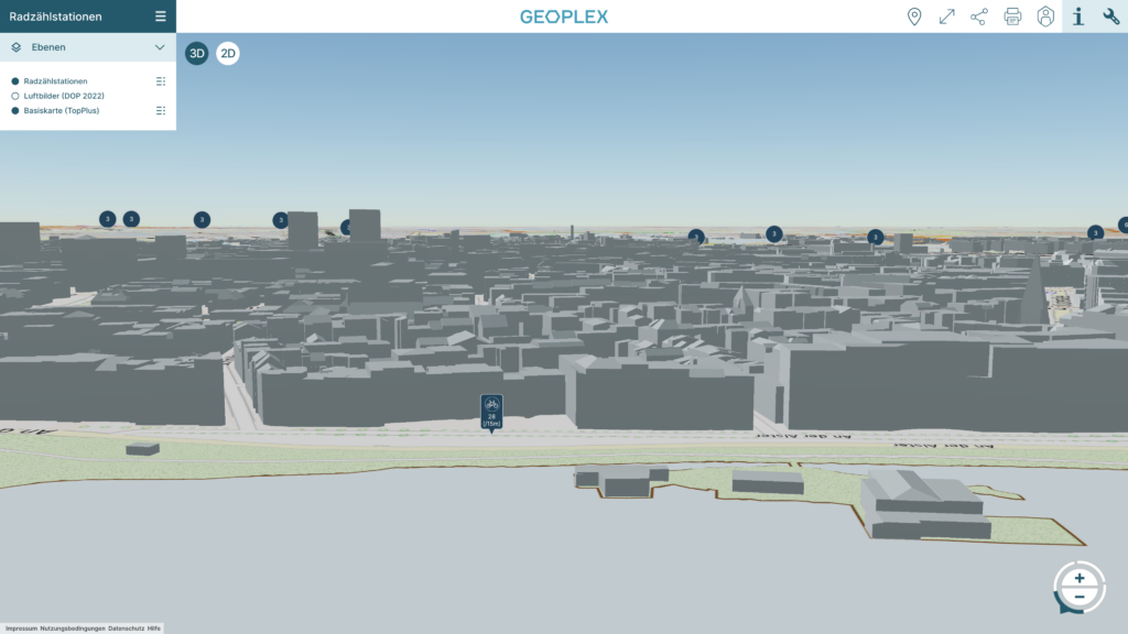
PlexMap 8 further improves the display of live data. The query window now has a dynamic, content-dependent size. Line breaks in the query window can be forced with Enter. The query window now has rounded corners, and the text and outline colors can be set in the backend. Icons can now be used in the query window. Ten icons for live data have also been designed and can be selected in the backend. The clustering and declustering of live data in the viewer has been improved, and the query windows are now generally displayed more sharply (anti-aliasing).
Update: Measure tool
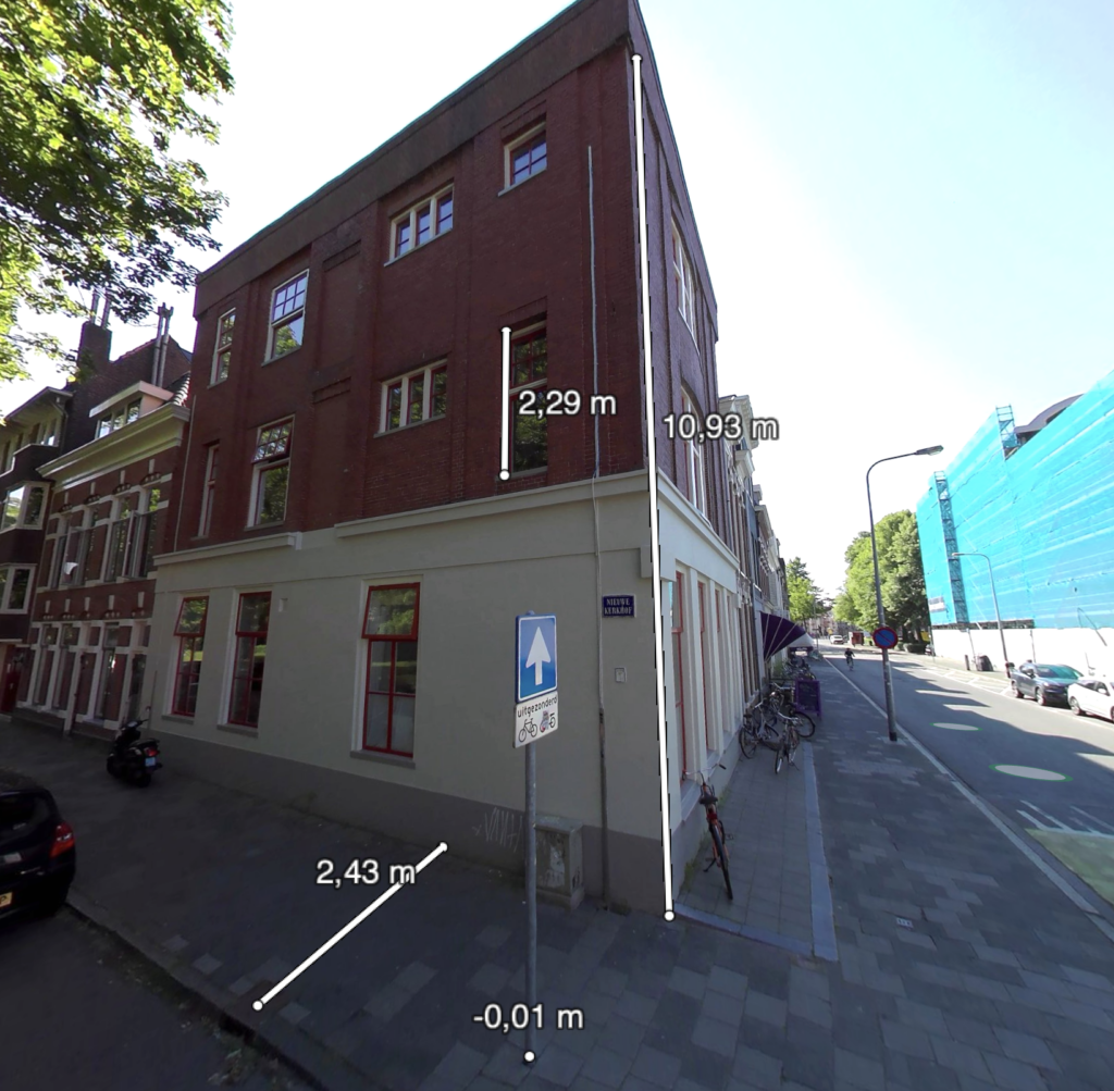
The update provides a uniform display of measurements across all measurement tools (e.g., 3D measurements = white and 2D measurements = blue). The functions of the individual tools have also been standardized and improved. Users can now delete, rename, and export measurements in all measurement tools. Measurements can now be terminated in any mode by pressing ESC. In addition, two redundant measurement modes have been removed from PlexMap 3D. There are also many other detailed improvements: display of inclination, improved titles, uniform results table, etc.
New: Geology tool
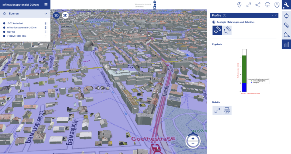
In collaboration with the city of Darmstadt, Geoplex and the Hessian Agency for Nature Conservation, Environment and Geology (HLNUG) have developed a new geology tool. The tool enables the measurement of boreholes and sections for the investigation of the geological subsurface in PlexMap 3D. The tool is integrated into the “Profile Tool” of PlexMap 3D and is therefore freely available to all users with a license for PlexMap 3D Pro Tools.
Further Updates
- PlexMap Viewer: Multiple selection in the backend: In any list view, multiple objects can now be selected to perform bulk actions (e.g., delete or tag).
- Layer styling: The style editor has been restructured and improved in detail.
- Layer styling: New visualization type “Graphic”.
- Layer styling: New visualization type “Billboard”.
- Help button now available in every viewer tool.
- General user guide for the viewer available.
- Marquee effect added for long view titles.
- Accessibility statement integrated (BITV).
- The size of the side query window and overview map is now adjustable.
- OGC API: PlexMap 8 now provides read support for various parts of the OGC API (Features, Vector Tiles, 3D GeoVolumes).
- Switchboard: Optional function parameters are now labeled.
- New function “Offset Curve”.
- New function “Points along Line”.
- Various new functions for volumetric objects (Mesh).
- New function “List Layers”: Multiple layers in a vector file can now be read, filtered, and specified.
- New function “Optimize Mesh”.
- New function “Simplify Mesh”.
- Power line function now accepts any 3D models (and suspension points).
- In the new layer parameter “config”, previously defined layer settings can now be applied (“adopt good settings”).
- Mesh Preview: The 3D object preview in PlexMap Magazine has been modernized and enhanced with many new features (e.g., display wireframe, show surface normals, display axis cross, fullscreen mode).
- CityObject Enhancements: Support for CityGML 3.0.
- DXF enhancements: Separate layers per object and surface class.
- Performance improvements for import/export and other detailed enhancements.
- POI (Points of Interest): In the POI editor, layers can now be specified to automatically turn on or off when a POI is activated.
- Render Settings Tool: New setting: “Full screen resolution” (highly recommended to try!).
- PlexMap Oblique: The side menu for oblique imagery selection can now be set to show only one direction.
- Full texturing of CityObjects is now possible (no workaround via Mesh required).
- Support for 16-bit RGB images in data storage.
- New REST API functions allow integration of oblique imagery layers into other software solutions.
- PlexMap Planner: 2D datasets can now be uploaded (e.g., Shape files).
- Planner tools can be disabled per view (helpful if the planner is to be opened for laypersons).
- Cutout polygons improved (both convex and concave polygons can be used).
- New models added to the 3D library: 20 trucks, 4 new conifer trees, and 13 new deciduous trees.