

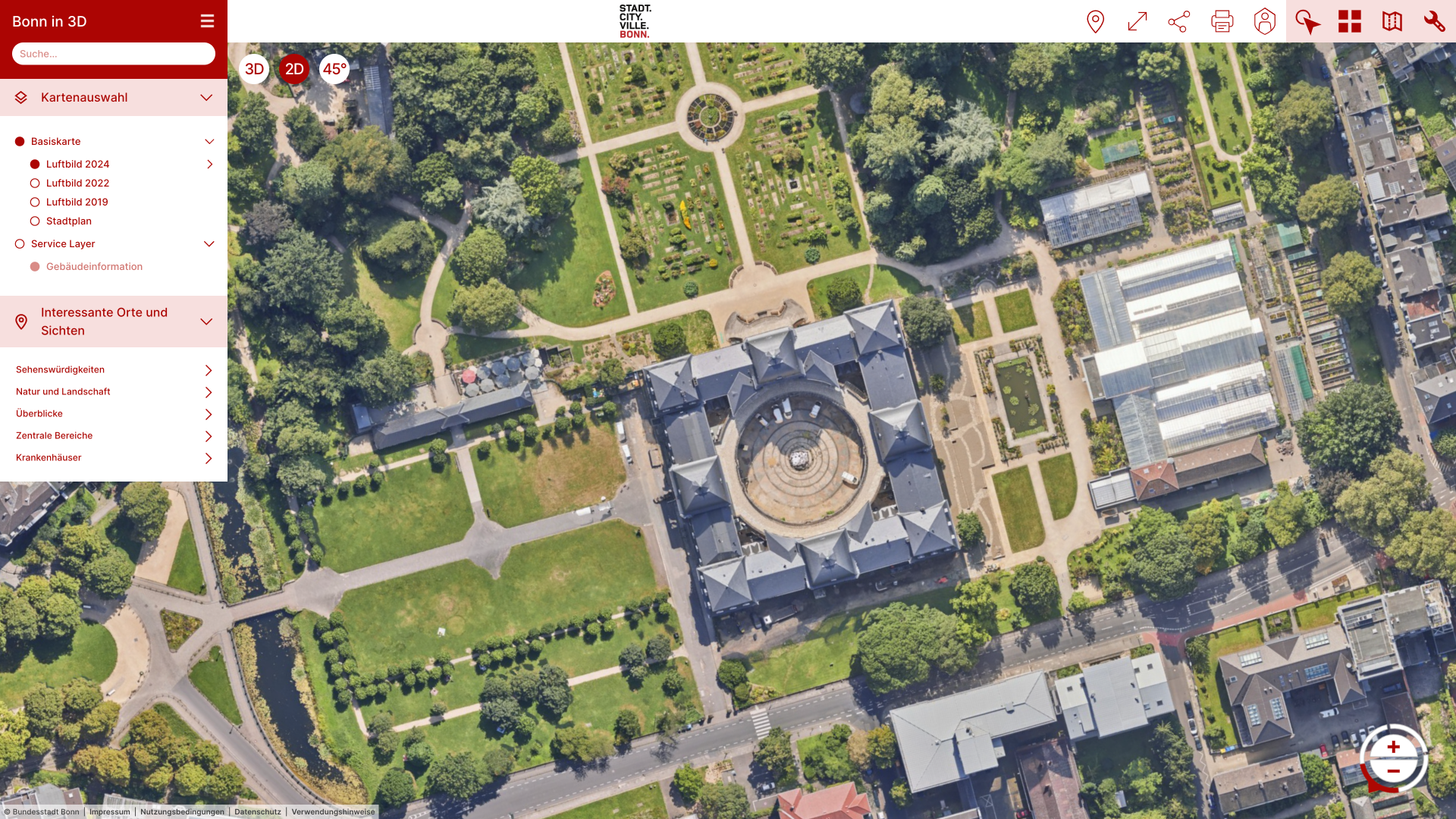
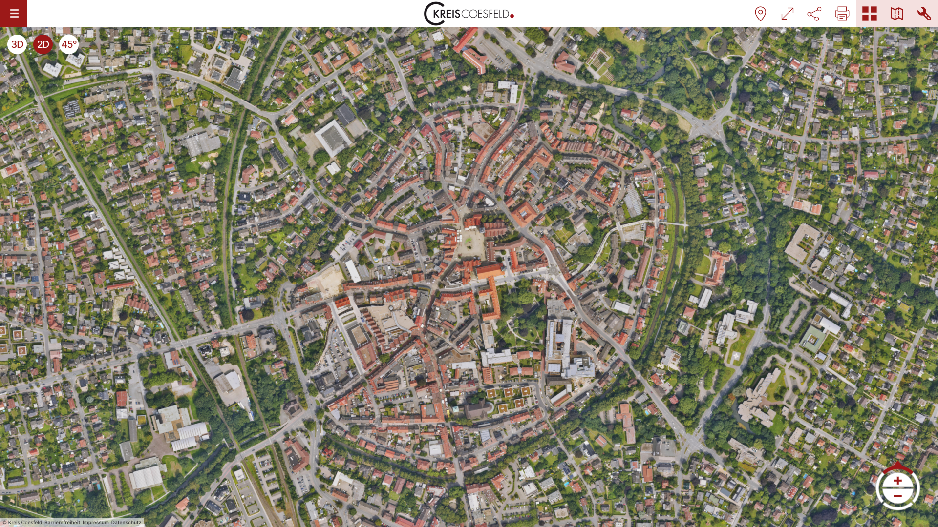
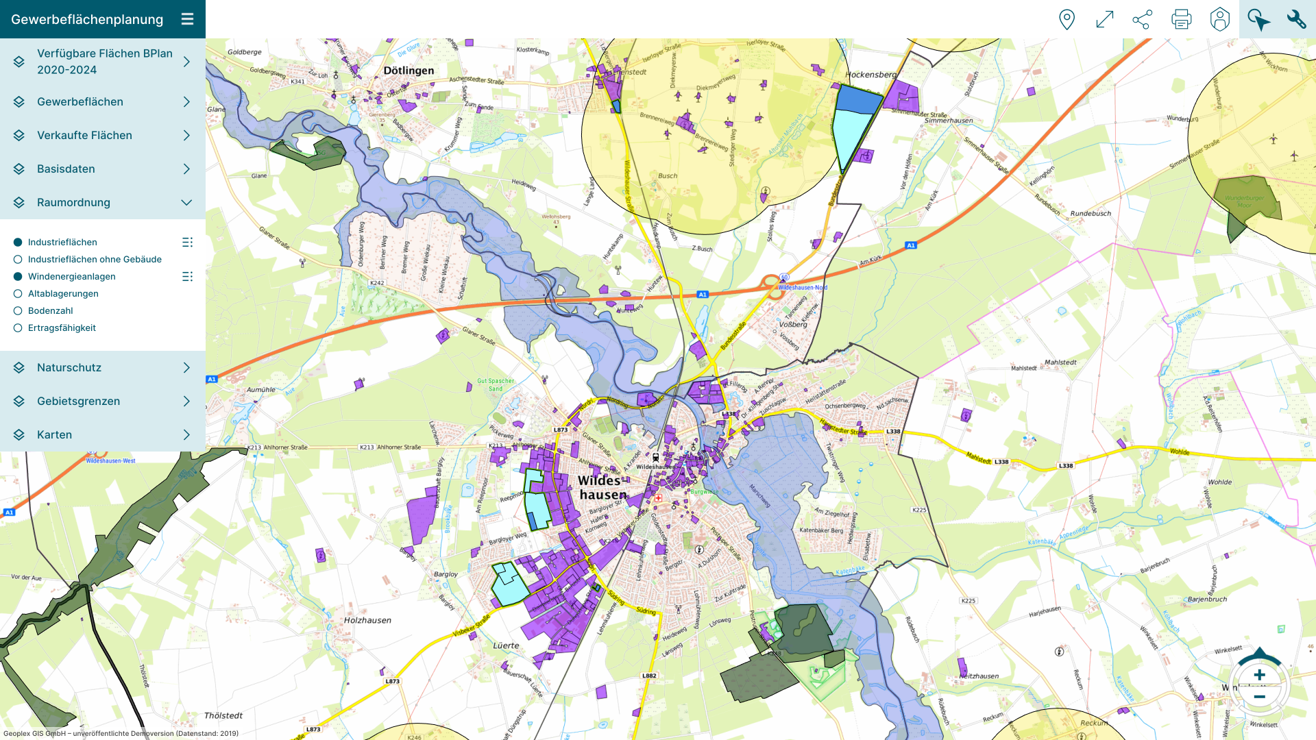
PlexMap 2D is an app for presenting and editing two-dimensional geodata online.
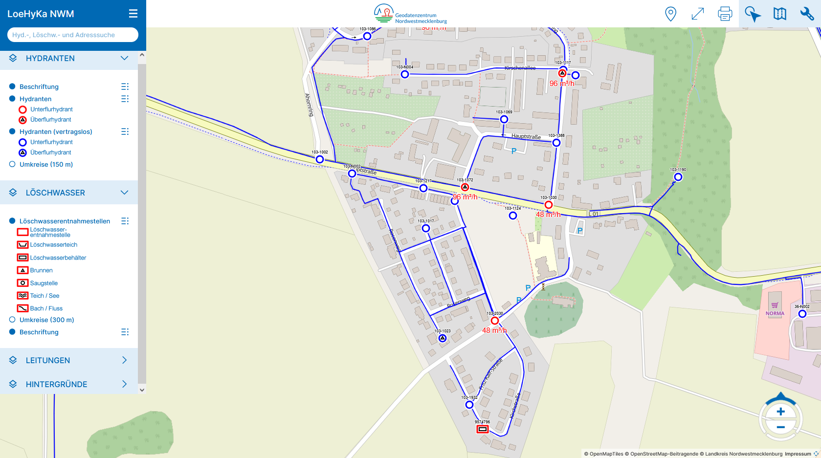
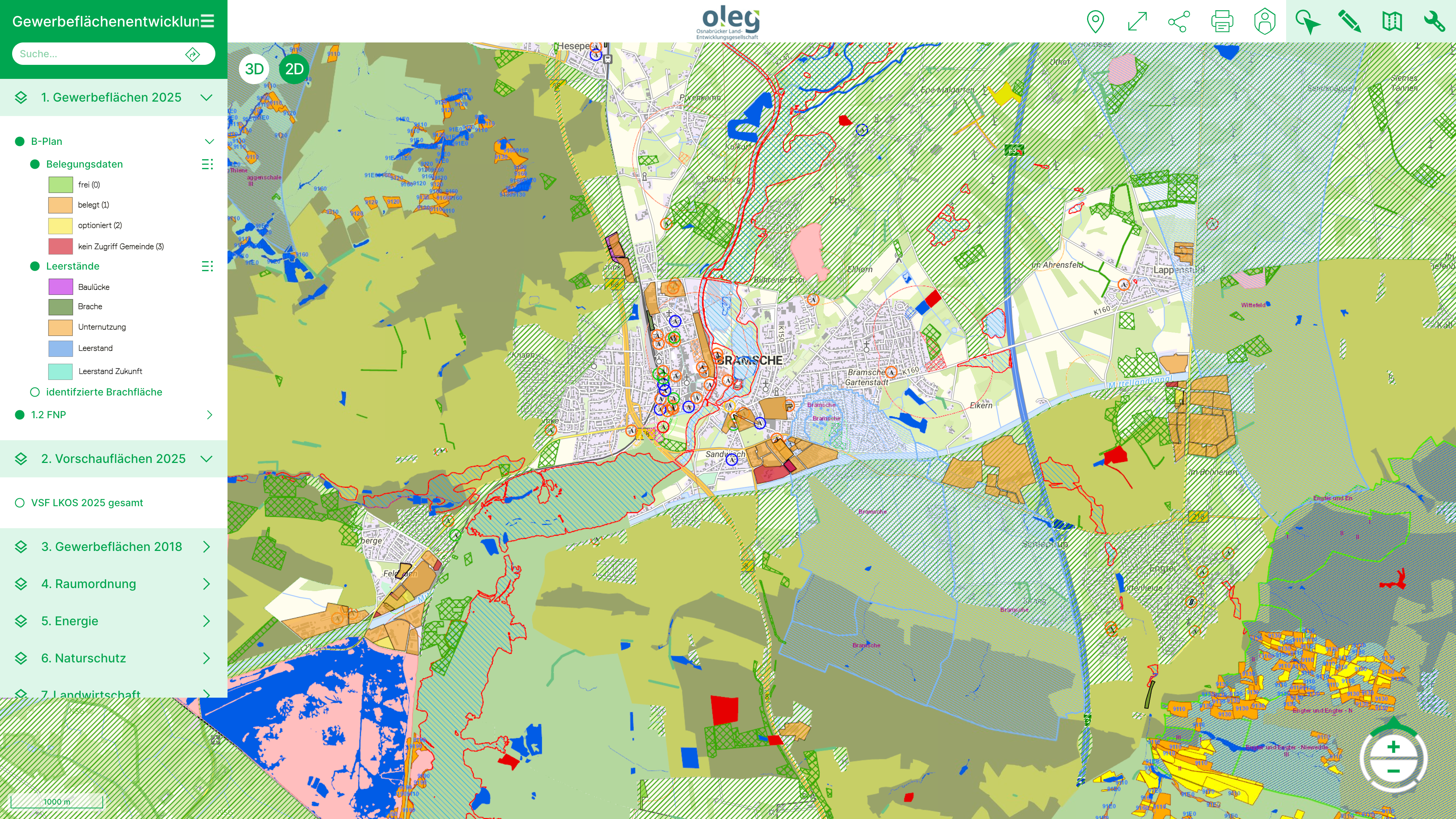
With PlexMap 2D, all traditional information systems of a modern administration are technically feasible (FNP information, ALKIS, tree cadastre, and much more).
Mapping citizen-oriented services and internal processes is simple and efficient with PlexMap 2D. Build & Maintain Information Systems.
Set up and maintain 2D information systems
PlexMap 2D was designed for the development of professional map applications and offers a comprehensive range of features that meet the needs of demanding professional users.
If necessary, you can expand PlexMap with additional apps at any time and thus integrate, for example, three-dimensional geodata or oblique aerial photographs into your map application.
Vorteile
PlexMap 2D offers more than just market-leading performance. Easily create, publish, and edit web maps. Learn all about the advantages of PlexMap 2D!
- Market-leading performance: Using “vector tiles,” PlexMap 2D displays vector data (e.g., shape files) instantly, without loss and without reloading.
- PlexMap 2D is based on free software (OpenLayers). We rely on open interfaces (e.g., WMS/WFS, OGC API) and thus offer considerable advantages over proprietary software.
- Intuitive user interface and continuous improvements thanks to our rolling release concept.
- Full support for smartphones and tablets thanks to responsive design.
- Extensive measurement functionality (lines, points, and polygons)
- Print editor: Custom printing in various formats
- Selection and export of 2D data
- Access external geoportals (2D and 3D) from PlexMap 2D.
- Coordinate tool: Read and search for geocoordinates.
- Services tool: Import and display external WMS/WFS services, SHP, and GML into PlexMap 2D.
- Viewer modes: Smooth transition to 3D data, oblique aerial images, point clouds, and street panorama images possible.
- PlexMap Planner: Create and customize new geometries and store attributes.
- PlexMap Planner: Add new geometries to existing datasets, customize geometries, and store attributes.
Tools

Coordinates
With the coordinate tool, you can read, search, and change the current coordinate system.

Measure
PlexMap provides various measurement tools. The measurement tools offered vary depending on the view mode.

External Links
Using the “External Links” tool, you can access external map applications (e.g., an existing geoportal) from PlexMap.

Export
With the export tool, you can export map objects in various data formats.
Feedback
Add-on
PlexMap Planner: Editing & Attributes
With the PlexMap 2D Planner, you can draw, style, and assign attributes to two-dimensional geometries (polygons, lines, and points).
In addition to capturing new data (schema-less editing), schema-based editing of existing geometries (e.g., tree cadastre) is also possible. Every captured geometry is automatically saved and can be accessed in the PlexMap Magazine.

Add-on
Single Sign-On (SSO) & LDAP Connection
As the user base grows, it can be useful to conveniently implement PlexMap login via single sign-on, e.g., with LDAP. This uses the identity provider provided by the client (OpenID Connect or SAML 2.0).
Users can then simply identify themselves with their employer’s general login credentials and no longer need their own PlexMap password. This also largely automates the allocation of user rights and user management (e.g., when an employee leaves) as well.

Live-Demo
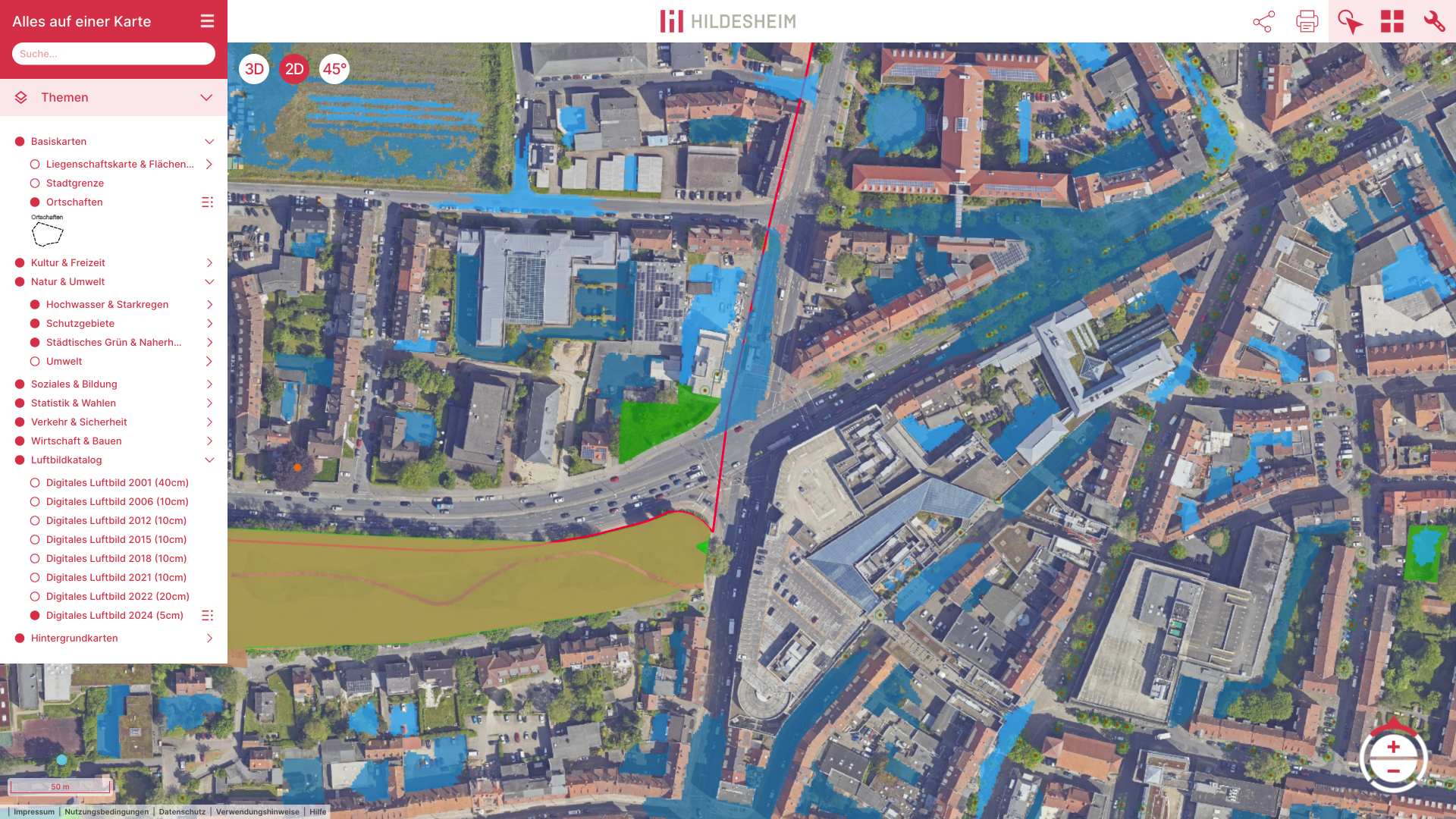
Try out PlexMap 2D using the example of the Hildesheim geoportal.
Get in touch
We would be happy to advise you personally. Send us an email at sales@geoplex.de
or call us directly at +49 (0)541 977695-90