

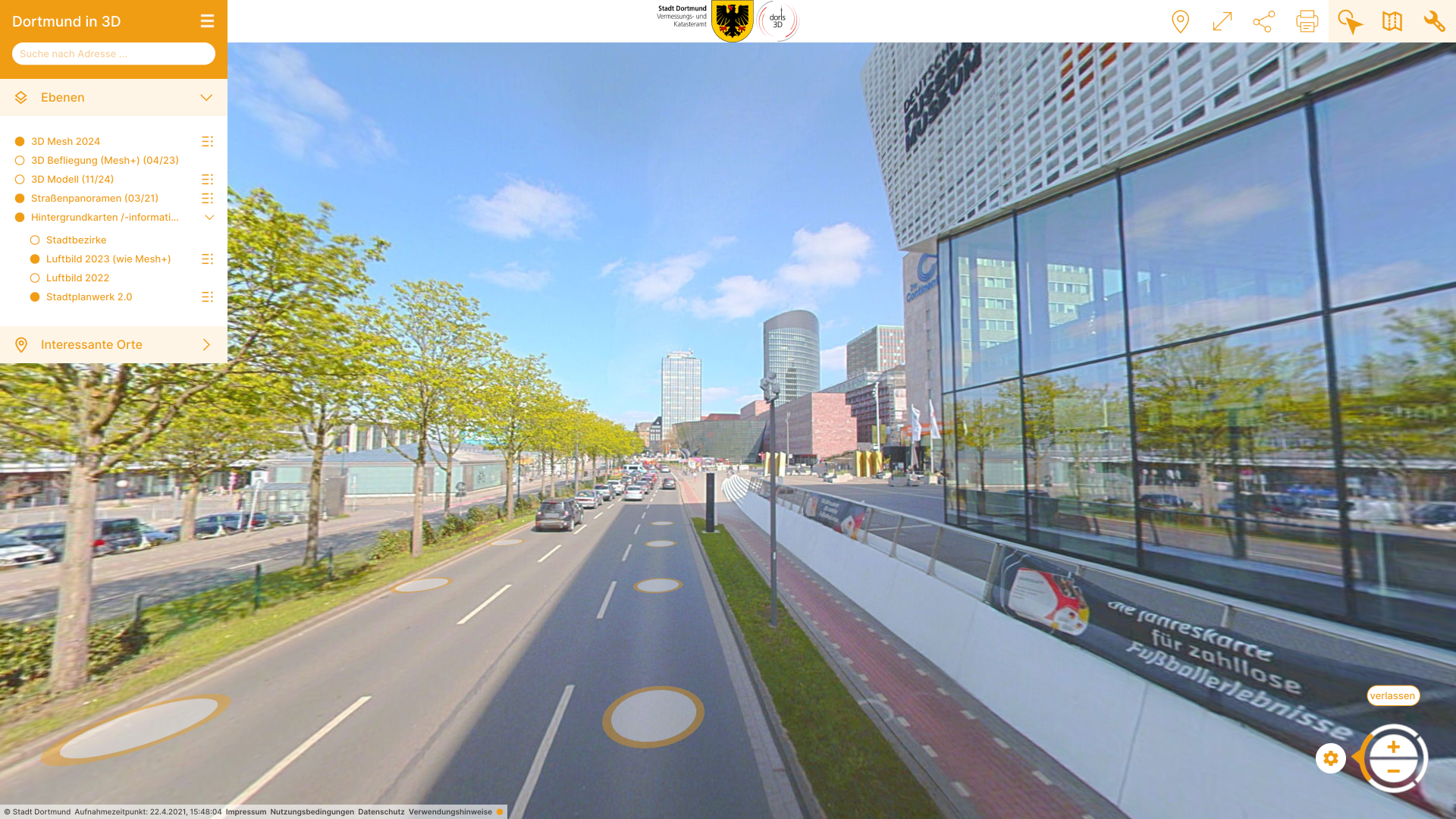
PlexMap Street360° is an app for visualizing street panorama images.
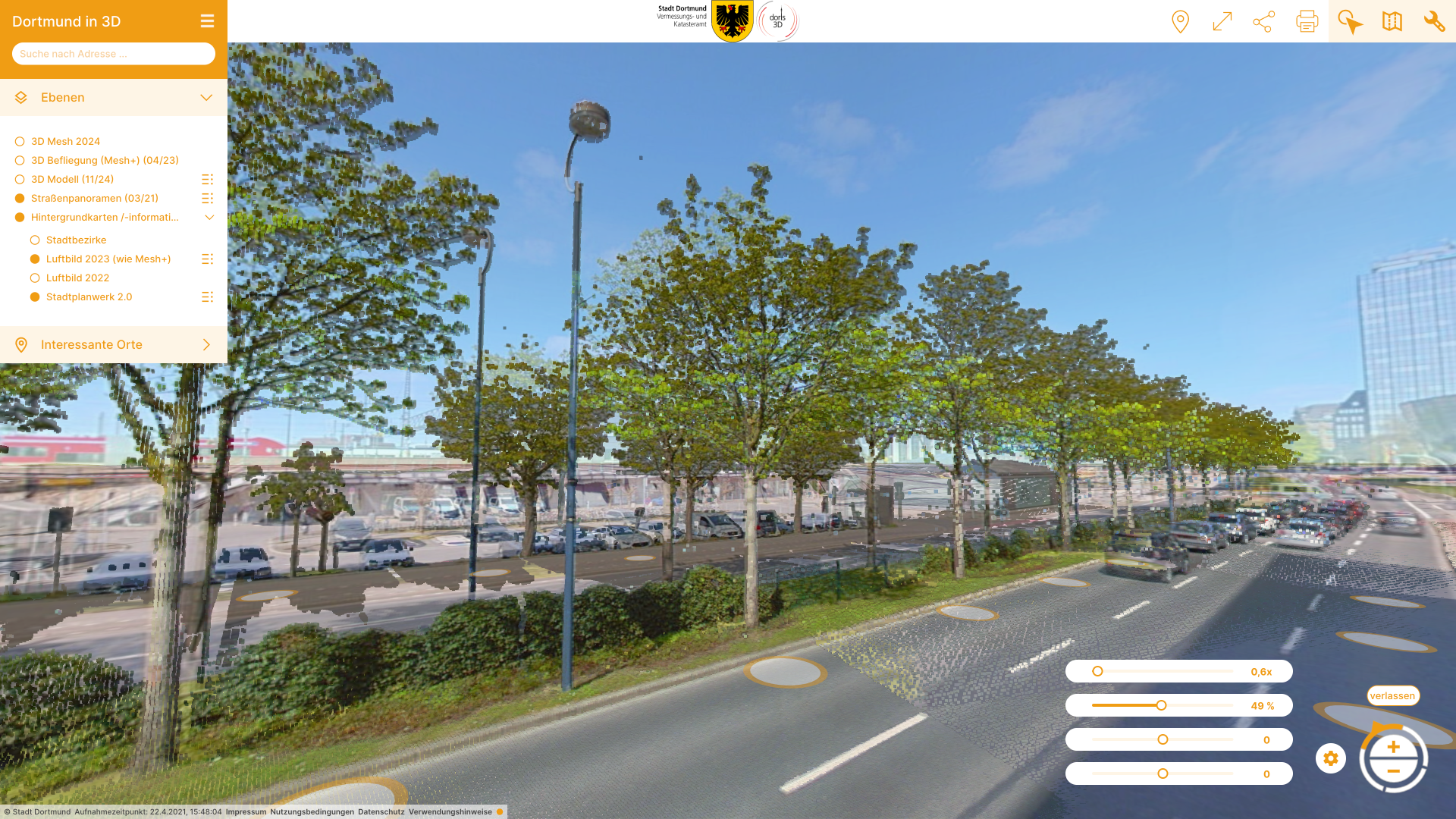
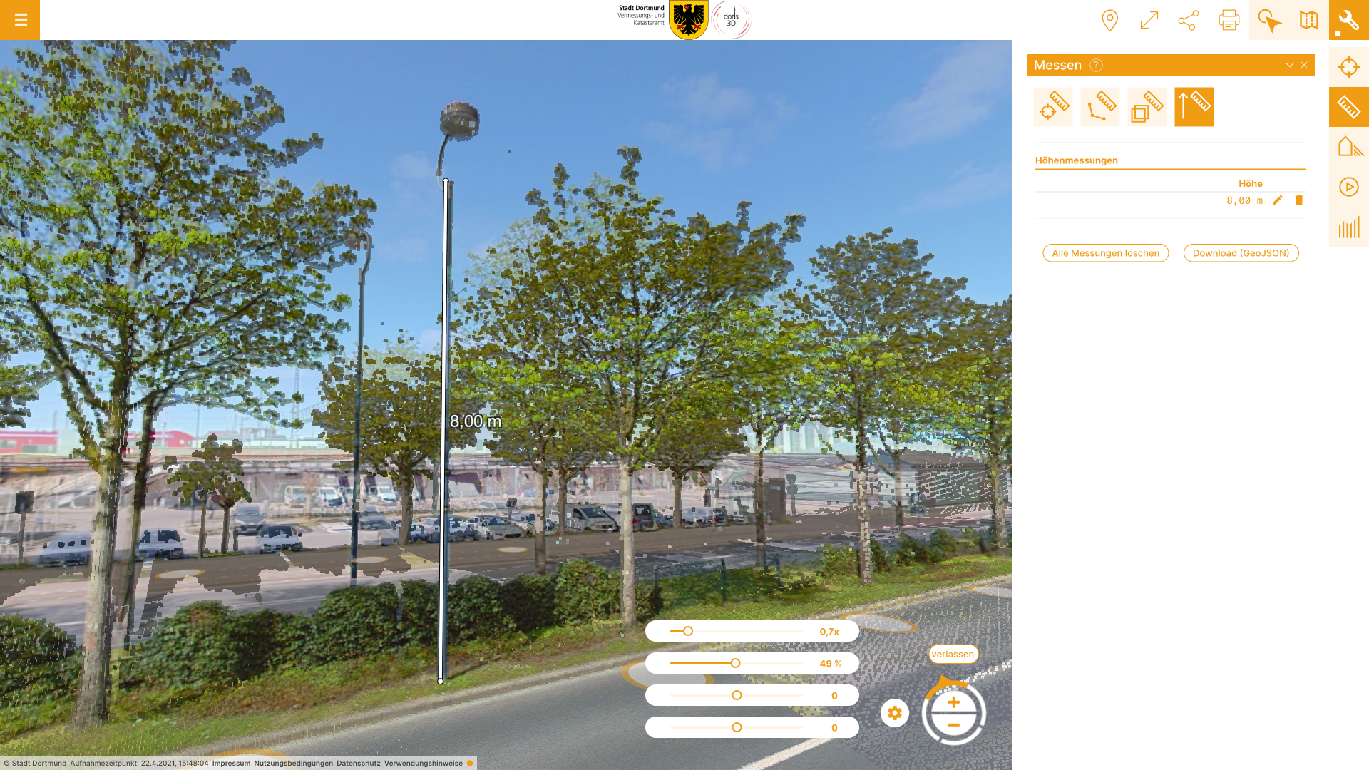
With PlexMap Street360°, one can visualize street panorama images together with the 3D city model and other two- and three-dimensional geodata. In addition, you have extensive tools at your disposal for performing measurements in the panoramas.
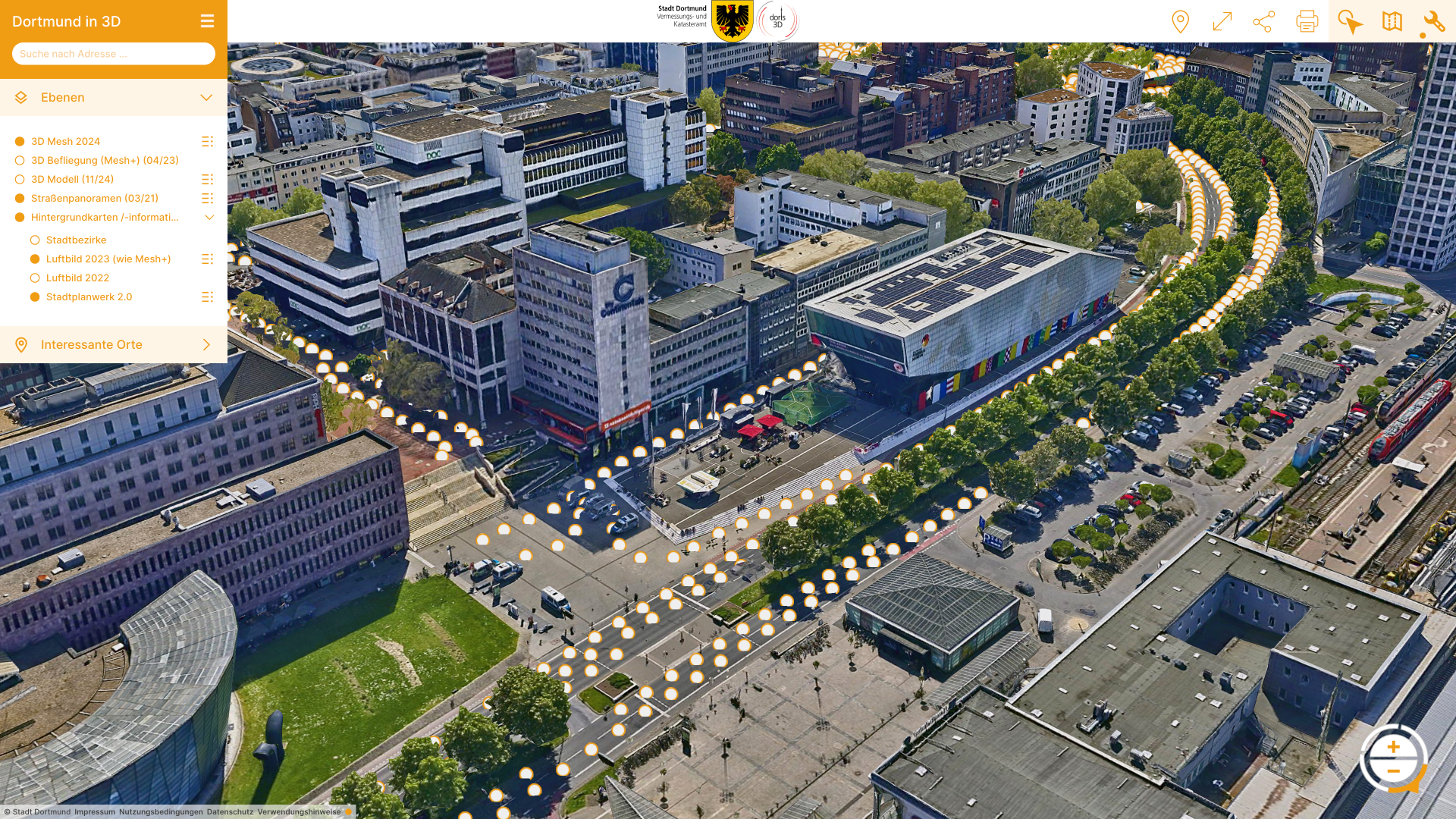
Integrating street panorama images into your digital twin
360° street panorama images have become established in many places in recent years. Panoramas ensure cost efficiency and facilitate communication within agencies, particularly by eliminating the need for on-site inspections.
In combination with a 3D city model, they offer interesting application possibilities, particularly in the areas of traffic and urban planning, surveying, and geoinformation.

Vorteile
PlexMap Street360° enables the intuitive visualization of street panoramas directly from PlexMap 3D. Learn all about the advantages of Street360°.
- Integrate street panorama images as layers into your 3D city model
High performance and intuitive user experience
Easy navigation between individual images
Integration of attributed 2D geodata possible (tree registers, street signs, and much more)
Activate WMS and WFS services
Transparency slider for comparing image data with other geodata
Extensive measurement functions available (x, y, z axes)
Extensive printing function available
Saving street panorama images including versioning
Integration of historical panoramas into the viewer
PlexMap Street360° is a web application. This significantly simplifies the distribution of images within the agency.
Tools

Coordinates
With the coordinate tool, you can read, search, and change the current coordinate system.

Measure
PlexMap provides various measurement tools. The measurement tools offered vary depending on the view mode.

External Links
Using the “External Links” tool, you can access external map applications (e.g., an existing geoportal) from PlexMap.

Export
With the export tool, you can export map objects in various data formats.
Feedback
Add-ons
Accessing street panoramas from PlexMap 2D
By default, PlexMap Street360° is an extension of PlexMap 3D. Alternatively, it is also possible to access the street panoramas via PlexMap 2D. This can either be done in addition to the existing panoramas or as the general gateway to your panoramas.

Add-ons
Single Sign-On (SSO) & LDAP Connection
If the user group grows, it may be useful to implement PlexMap login conveniently via single sign-on, e.g., with LDAP. This uses the identity provider provided by the client (OpenID Connect or SAML 2.0). Users can then simply identify themselves with their employer’s general login details and do not need their own PlexMap password. This also largely automates the assignment of user rights and user management (e.g., when an employee leaves the company).

Live-Demo
Schedule an appointment for a free product presentation
Get in touch
We would be happy to advise you personally. Send us an email at sales@geoplex.de
or call us directly at +49 (0)541 977695-90